01
Choose the area and imagery
Set the mapping boundary and select suitable Landsat or Sentinel imagery. Review dates, clouds and visible water conditions.
Shallow Water Mapper · LUWES
Turn satellite imagery into an initial view of shallow-water depth patterns. Shallow Water Mapper brings imagery, map processing and field reference points together to help plan the next survey.
From imagery to a first map
The aim is to understand patterns and identify areas for closer review. Reference measurements help assess how the estimates behave at your location.
Set the mapping boundary and select suitable Landsat or Sentinel imagery. Review dates, clouds and visible water conditions.
Correct the imagery, inspect colour and near-infrared information, then run depth prediction and review the mapped patterns.
Compare estimates with measured depth points. Use the findings to plan validation and further field work.
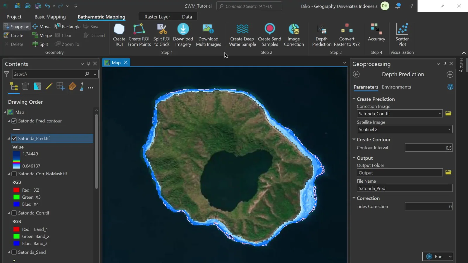
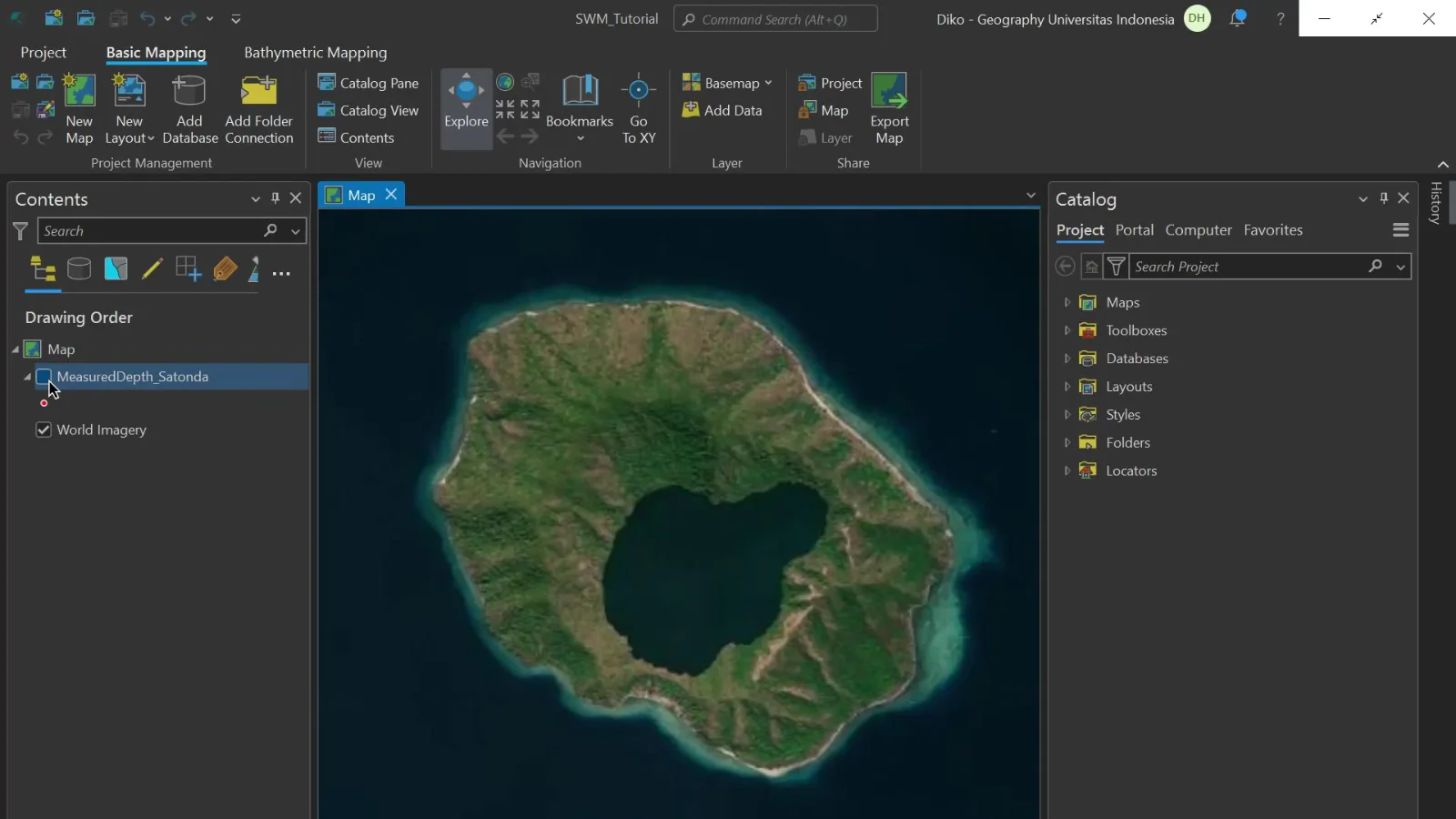
These views show the same example area. The first provides geographic context; the second adds a predicted depth layer and contours for review.
Identify areas where field depth measurements could add useful context.
Bring an initial map into planning, resource reviews and research discussions.
Record the imagery date, model settings and field reference points alongside the map.
The working views make the processing steps visible. Expand the examples to inspect imagery layers and the comparison with measured depths.
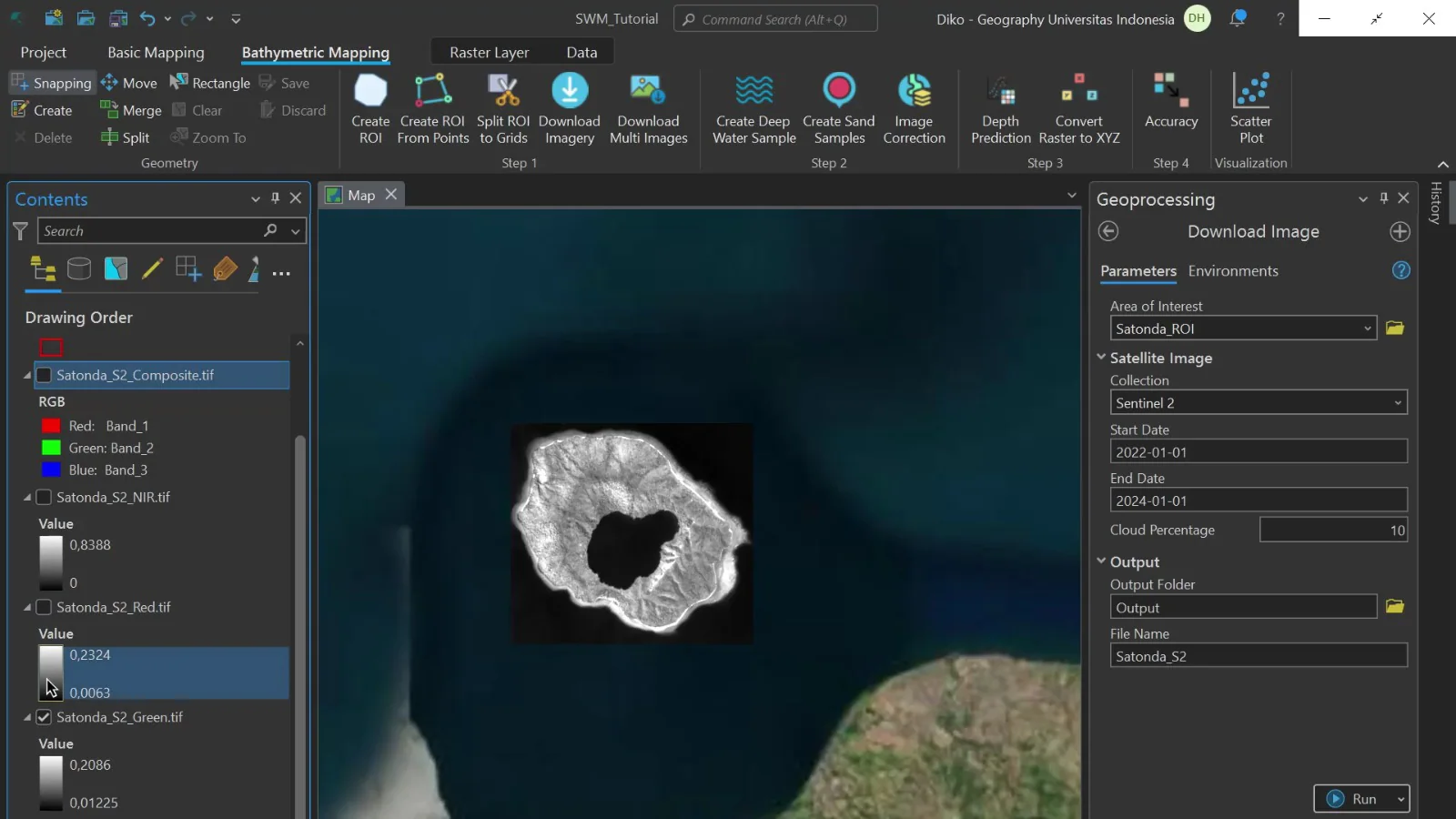
The example separates colour and near-infrared bands. Dates, cloud cover and image correction affect which information can support the analysis.
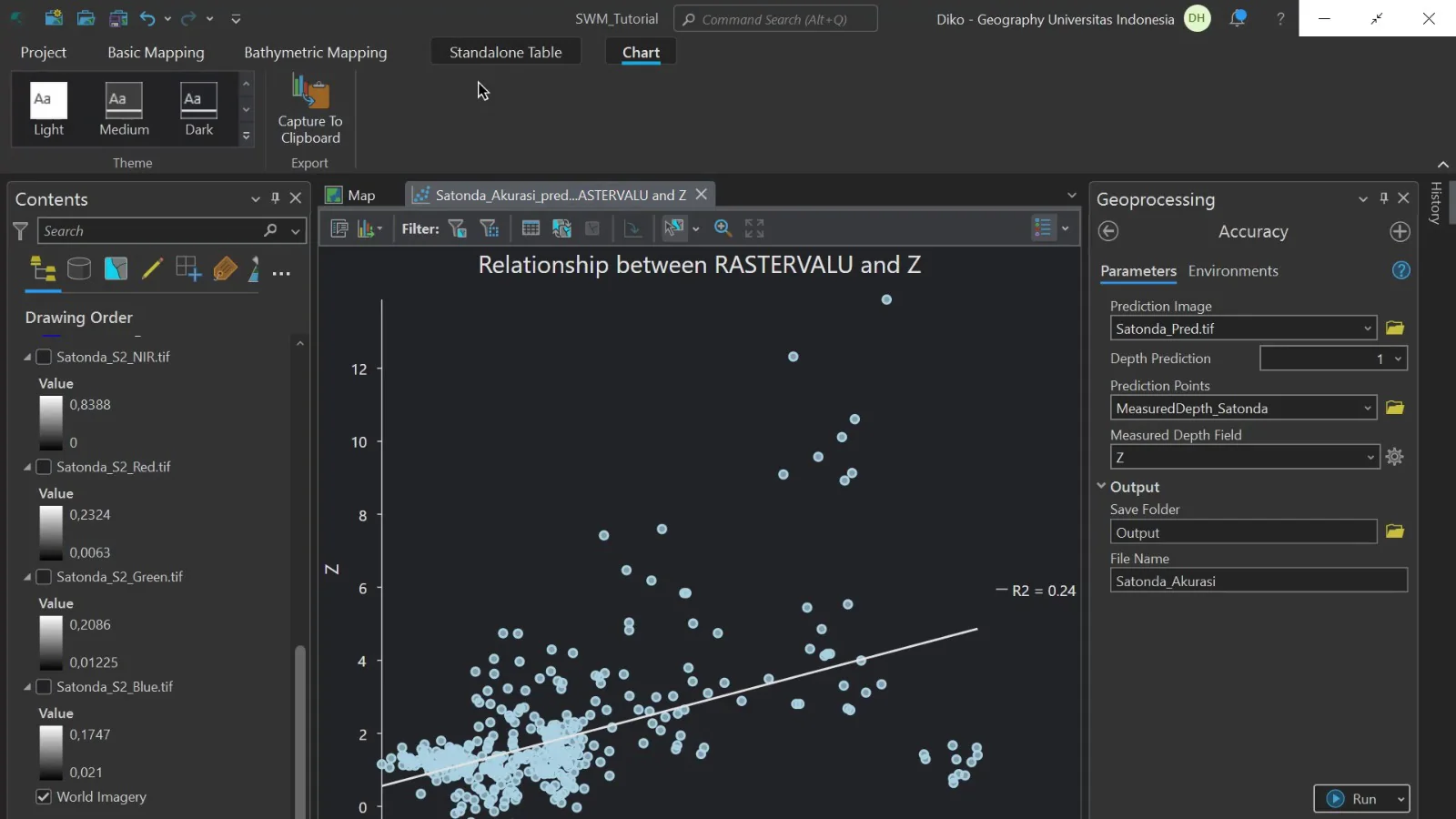
Each dot compares a model result with a reference depth. The scatter and fit statistics need to be assessed for this dataset; this example is not a general accuracy guarantee.
Water clarity, seabed conditions, waves, clouds and reference data affect the result. Use these maps for preliminary planning, with field validation and professional survey work where required.
Make an informed choice
Shallow Water Mapper estimates shallow-water depth patterns from satellite imagery and field reference data. It can help assess a wider area before planning further surveys. Begin with the water conditions and intended use of the map so unsuitable areas are identified early.
Cloud, reflected light, turbid water and a bottom that is not visible can limit image-based depth estimates. An assessment should check available image dates and usable coverage before promising a complete map. Deep or very cloudy water may need another survey method. Do not assume every coloured pixel represents a reliable depth measurement.
Reference depths help build and check the estimation. Their dates, position and height reference must suit the imagery and project. Ask which points are used to develop the result and which independently check it. Tide or changing water level needs attention when relevant. A familiar-looking map is not a substitute for documented uncertainty and limits.
Discuss the area boundary, map scale, coordinate system, imagery, field work and output formats. Ask for usable-area masks, validation results and a clear account of locations that could not be assessed. Define whether the scope ends at an initial depth map or includes additional field surveys, report preparation and support for your mapping software.
An initial map can help identify places to investigate, compare broad patterns and plan survey effort. It should not automatically be treated as a certified navigation, dredging or engineering survey. Ask whether the proposed method and validation meet the requirements of your decision. The quotation should separate imagery, processing, field work, review and further survey costs.
No. It estimates depth from image information using a defined method and suitable reference data.
Turbidity can limit the method. Review sample imagery and coverage before deciding whether another survey is needed.
Discuss suitable reference and independent checking data. Their availability determines how the result can be assessed.
Do not assume that. Navigation requires the applicable survey and approval requirements, beyond an initial depth estimate.
Agree supported formats, coordinate reference and required layers. GIS is software for working with geographic information.
Usable imagery, likely coverage, reference-data needs, limitations and a clear scope for the next stage.
These explain measurement or system principles. The equipment and service offered are confirmed in your quotation.
Share the area, purpose and field data you already have. We can discuss suitable imagery, validation and the expected mapping output.