From Weather Data to Better Decisions: Turning Forecasts into Operational Intelligence
Published
PT Luwes Inovasi Mandiri
Contributor: Dewa Bagus Odie
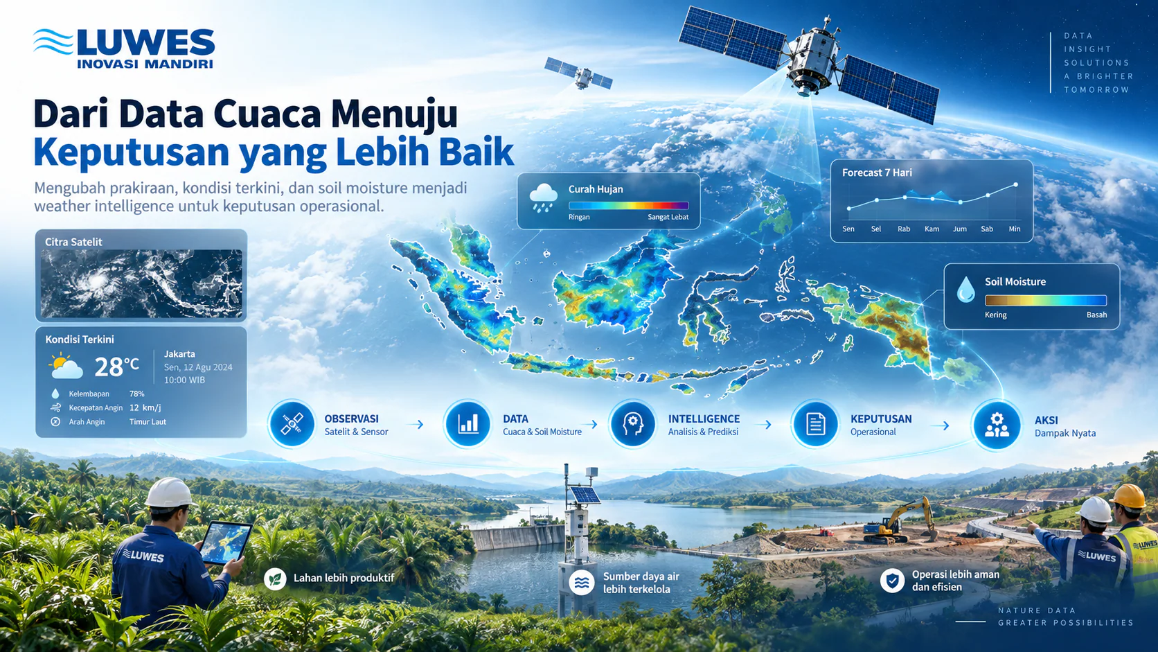
Weather data becomes more valuable when it helps answer operational questions. Discover how Luwes Inovasi Mandiri transforms current weather, high-resolution forecasts, and soil moisture information into actionable weather intelligence.
From Weather Data to Better Decisions
Weather affects many operational activities, from agriculture and plantations to infrastructure, water management, construction, and field operations.
However, having access to weather data alone does not automatically lead to better decisions.
The real value appears when weather information can answer practical questions:
What is happening now? What may happen next? How could it affect operations? And what action should be taken?
This is where weather intelligence becomes important.
At PT Luwes Inovasi Mandiri, weather data from Spire can be integrated, processed, visualized, and transformed into information that is easier to use in operational environments.
Understanding What Is Happening Now
Operational decisions often begin with understanding current environmental conditions.
Through Current Weather Conditions, users can observe meteorological parameters such as precipitation, temperature, humidity, atmospheric pressure, wind speed, and wind direction.
Instead of looking at individual numbers separately, the information can be presented spatially on a map or integrated into an operational dashboard.
This helps organizations build situational awareness before carrying out activities in the field.
For example, a field team may need to know whether rainfall is currently developing around an operational area before deploying personnel or equipment.
The first question weather intelligence needs to answer is therefore simple:
What is happening right now?
Looking Beyond Current Conditions
Knowing the current weather is important, but many operational decisions need to be made several hours or even days in advance.
This is where forecasting becomes critical.
High Resolution Forecast allows future atmospheric conditions to be analyzed across both location and time.
Instead of only asking whether rain is possible, users can begin asking more specific operational questions:
When is rainfall expected?
Which areas may experience higher rainfall intensity?
How long could unfavorable conditions continue?
Is there a better time window for field activities?
Forecast information can therefore move beyond traditional weather visualization and become part of operational planning.
Adding Soil Conditions to the Picture
Atmospheric conditions are only one part of the environment.
For agriculture, plantations, drought monitoring, and land management, understanding the condition of the soil is also important.
Satellite-based observations and modeling can provide information about soil moisture, helping users understand how wet or dry an area is.
This adds another layer of context.
Instead of only asking:
Will it rain tomorrow?
Operational teams can begin asking:
What is the current soil condition, how could it change, and what does that mean for the activity we are planning?
The combination of atmospheric and surface information provides a more complete perspective than relying on a single weather parameter.
From Weather Data to Weather Intelligence
Weather intelligence is not simply about collecting more data.
It is about connecting different information sources to operational needs.
Current weather helps describe what is happening now.
Forecast information helps describe what may happen next.
Soil moisture provides additional context about surface conditions.
When these datasets are combined with operational rules, locations, assets, and activities, they can become a decision-support system.
The result is no longer just:
“Rain is forecast tomorrow.”
It can become:
“Based on the forecast and current environmental conditions, tomorrow morning provides a better operational window than the afternoon.”
That transition—from data to context—is where weather information becomes operational intelligence.
One Weather Data Ecosystem, Multiple Applications
The same weather data can support different applications depending on the operational problem being addressed.
In agriculture, weather and environmental information can become part of precision farming applications such as GoAgri, supporting decisions related to field activities and fertilizer planning.
For fire-risk monitoring, meteorological variables can be processed into indicators such as the Fire Weather Index (FWI).
In water-resource monitoring, precipitation information can be combined with field instrumentation such as Automatic Water Level Recorders (AWLR) to provide broader hydrometeorological context.
Similar approaches can also support infrastructure, mining, energy, construction, and other sectors where weather directly affects operational risk and productivity.
Connecting Data with Field Decisions
Satellite observations, weather models, IoT devices, APIs, and dashboards are powerful technologies.
But the final objective is not the technology itself.
The objective is to help people make better decisions.
At Luwes Inovasi Mandiri, weather intelligence can be integrated into dashboards, APIs, monitoring platforms, and purpose-built applications according to the needs of each operation.
The overall process can be summarized as:
Observation → Weather Data → Processing → Intelligence → Decision → Action
Because ultimately, the value of weather data is not only in knowing what the weather will be.
Its value lies in understanding what the weather means for what you need to do next.
Tags:
Thinking of using this at your site?
Start with the equipment and approaches below. Your site requirements determine the right setup.
- AWS: automatic weather stationChoose weather measurements that suit your field requirements.
- Spire weather forecast dataUnderstand how forecasts differ from measurements at your site.
- Field weather monitoringPlan weather measurements, monitoring locations and how the data will be used.