When might rain affect the work?
Review precipitation and its time period before scheduling a field visit or outdoor activity.
Spire Global × PT Luwes Inovasi Mandiri
SPIRE weather data helps you review conditions across your working area. Explore forecast maps and location charts to plan field visits, outdoor work and follow-up checks.
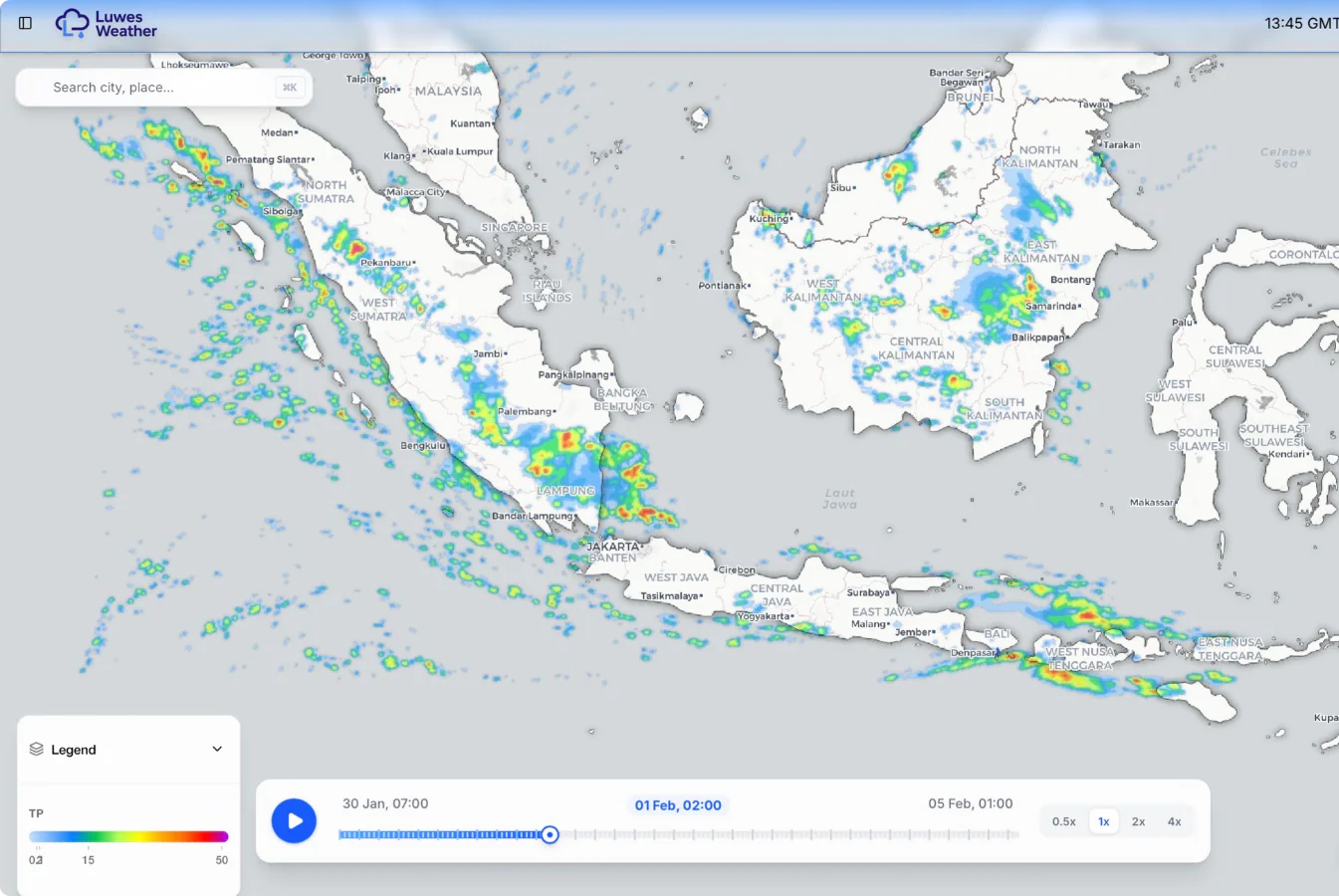
From map to field plan
Different activities need different information. Choose the location, time and variable that match the work you are planning.
Review precipitation and its time period before scheduling a field visit or outdoor activity.
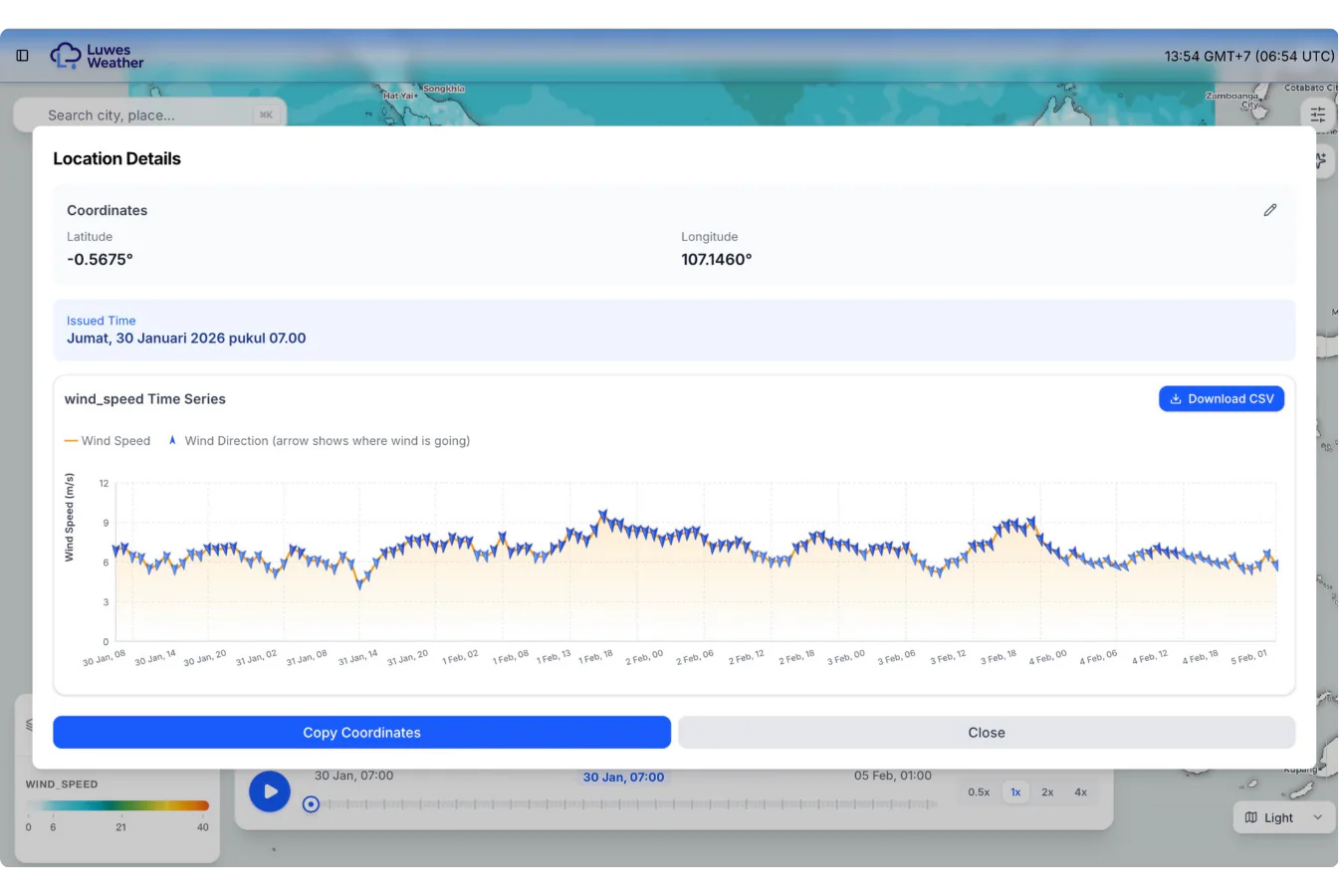
Compare forecast wind speed and direction over time using the location chart.
Soil-moisture information adds regional context for irrigation and dry-condition reviews. Confirm the selected data layer and coverage.
After choosing a location, move from the regional map to its time-series chart. The example shows wind speed in metres per second, with arrows indicating wind direction.
Forecasts are estimates. Combine them with local observations and your operating procedures.
Land and water context
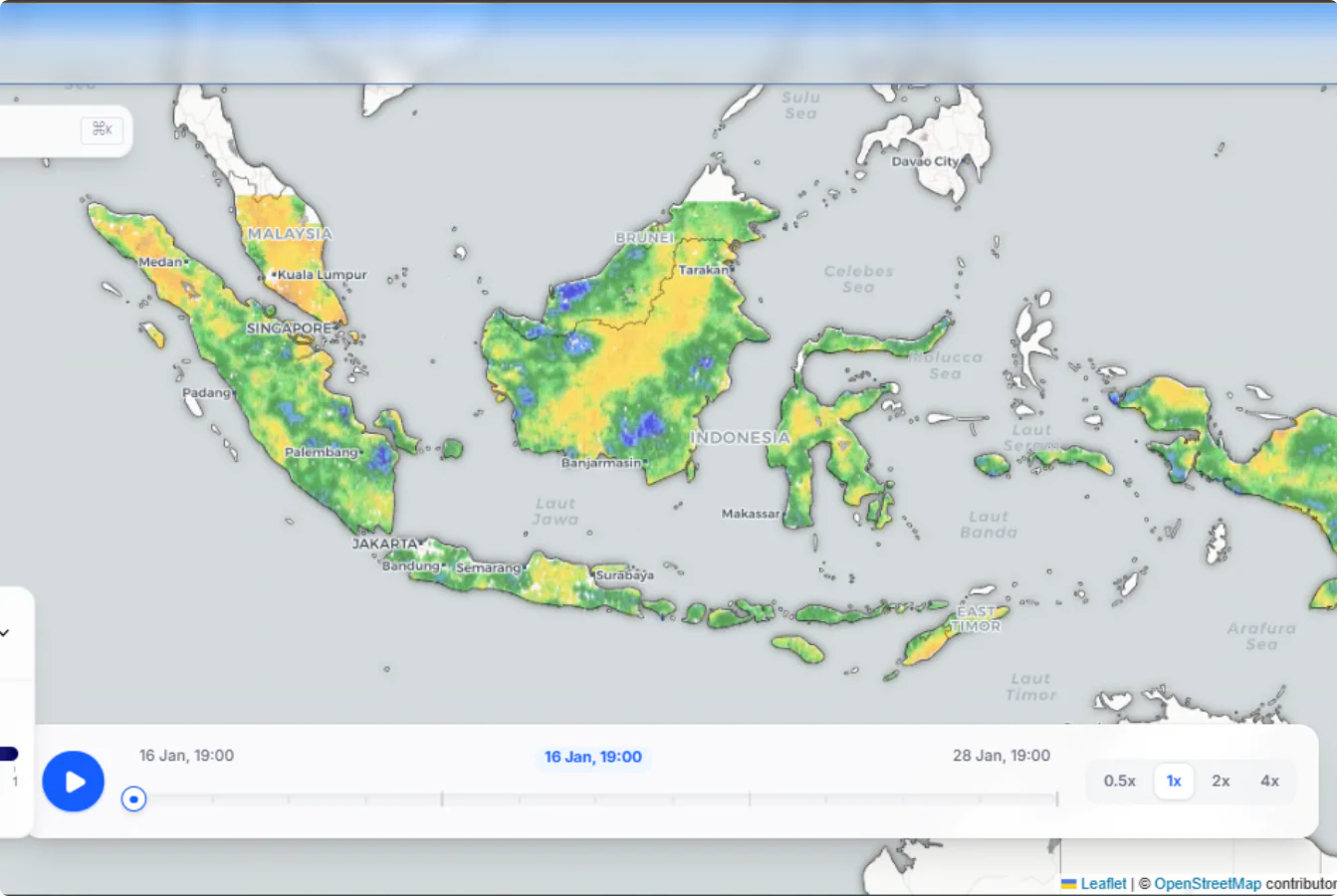
Compare regional changes to identify where a field check may be useful. Soil-moisture data complements site measurements rather than replacing a sensor at your plot.
Available variables, soil layers, dates and resolution depend on the selected data product. We can help match the service to your area and intended use.
Share the area, variables and timing you need. We will review available data and delivery options with you.
Make an informed choice
Spire supplies weather data; Luwes presents the monitoring and integration context on this page. Start with locations, the work you plan and the information people need to see. A map example is a useful preview, but the available data depends on the selected service.
A forecast helps plan ahead, while a station records conditions where it is installed. Consider both when teams need a local record and a wider view of approaching weather. A forecast is not a guarantee that rain or wind will occur exactly as shown. Review the latest update and local observations before acting.
Ask which locations, weather fields, update times and forecast periods are included. Spire offers multiple products and subscriptions; availability differs between them. Older six-day or seven-day examples do not define the package available for your location today. Confirm the exact forecast period, time zone and units in your proposal.
Discuss map access, location charts, downloadable files or an API, a connection that lets software request data. Confirm user access, permitted use, subscription charges and integration work. Internet access and service availability affect delivery. Soil-moisture data is a separate product choice and should not be assumed to be a direct sensor reading in your field.
Provide the area and the decision you need to support, such as scheduling a field visit or comparing rainfall risks across sites. Ask which example fields are actually available for that area and package. Agree how older forecasts, missing data and changes to the service will be handled, and who checks whether the information is useful in practice.
This page concerns weather data and its use. Physical sensors and an AWS are a separate equipment scope.
No. The selected subscription determines access. Specify products, region and permitted use in the proposal.
The forecast period depends on the selected product and delivery. Confirm it rather than treating an example as a fixed package.
Not necessarily. Check the product's method and coverage; compare with field measurements when local conditions matter.
Discuss the required data and receiving system. Access, usage rights and integration need confirmation first.
Data subscription, platform access, integration support and any usage-based limits or charges stated in the offer.
These explain measurement or system principles. The equipment and service offered are confirmed in your quotation.
Tell us where you work and what you need to review. We can discuss data and access that fit your task.