Luwes solutions / Weather monitoring
Weather Monitoring Solution
Measure weather conditions automatically to support planning and responses to extreme weather.
- Local measurements
- Forecast data
- One platform
Complete Weather Solution
Complete Weather Monitoring Solution
Combine measurements from automatic weather stations (AWS) with Spire satellite data to review local conditions and regional forecasts.
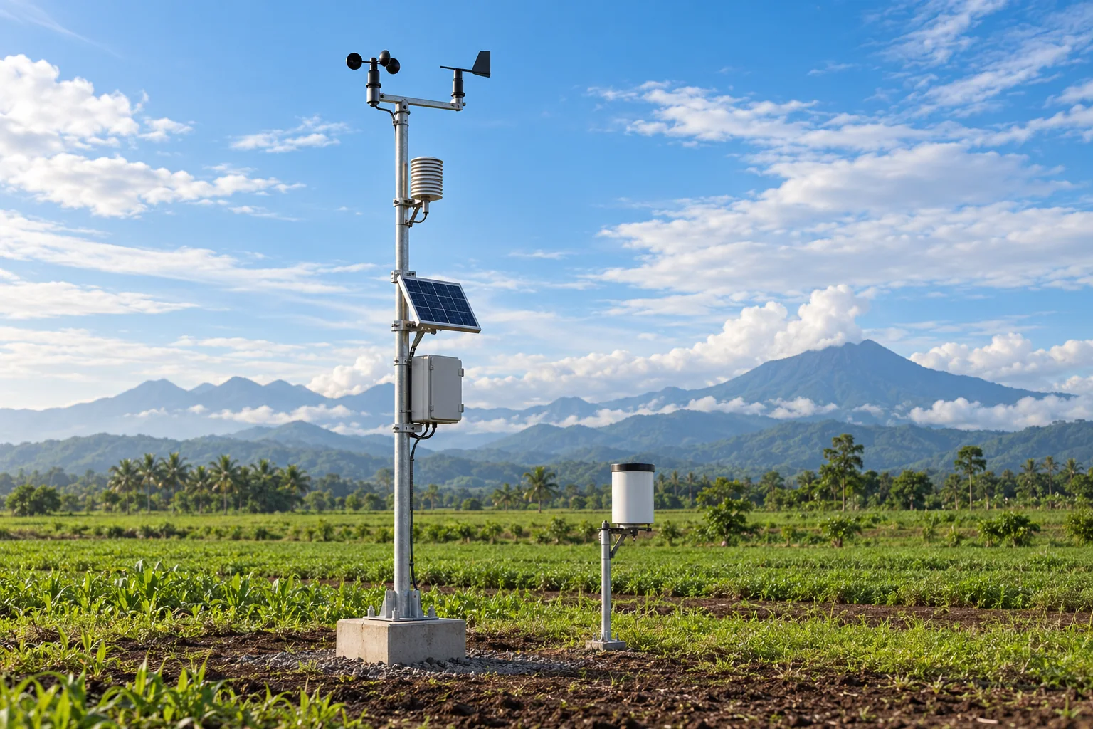
Automatic Weather Station
AWS Hardware
Physical weather monitoring stations equipped with precision sensors for measuring meteorological parameters in real-time with automatic data transmission.
Real-time multi-parameter weather monitoring
Sensor accuracy confirmed for each selected model
Solar and battery options sized for the site
Data connection selected for local coverage
Satellite-Based Forecasting
Spire Weather Data
Spire forecast data helps you plan around expected weather. Coverage, grid size, forecast period and updates follow the data package agreed for your project.
Coverage and map detail confirmed for your area
Forecast period and updates confirmed for the selected package
Soil moisture analysis for agriculture
Satellite and ground data fusion
Integrated Solution Architecture
01
AWS Sensor
02
Spire Data
03
Luwes Platform
04
Insights
Platform Overview
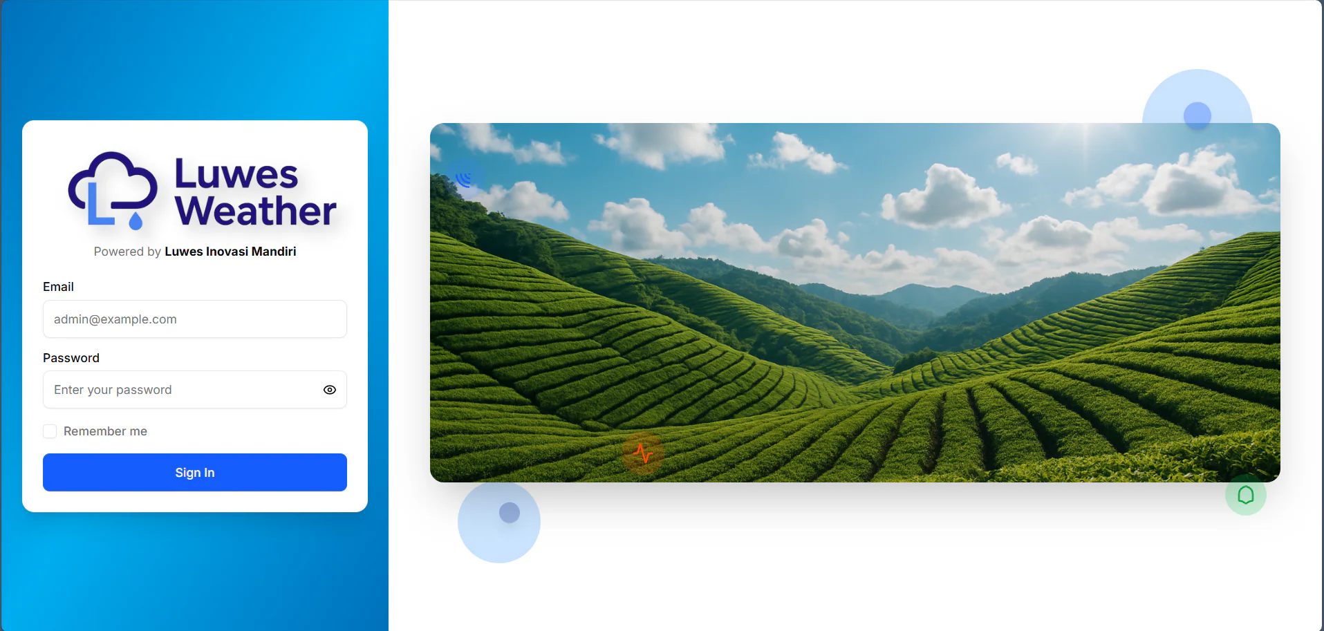
Luwes Weather Platform
View the latest weather readings, charts, and reports online with secure access from anywhere.
Real-Time Monitoring
Access live weather data and visualizations from your monitoring stations with automatic updates every minute.
Cloud-Based Access
Open the platform on a computer, tablet, or phone. Access permissions are managed for each user role.
Advanced Analytics
Comprehensive data analytics with historical trends, custom reports, and automated alert systems for critical conditions.
Hardware Component
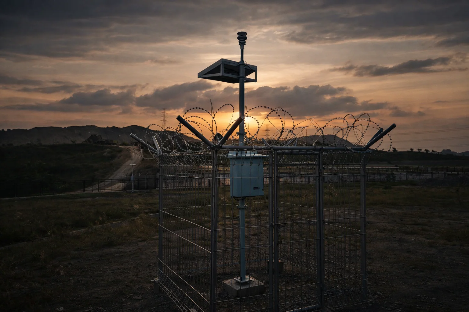
Automatic Weather Station (AWS)
Professional-grade automatic weather monitoring hardware with precision sensors and reliable data transmission.
Key Features
High Accuracy
Check the selected sensor model for accuracy, range and calibration requirements.
Solar Powered
Panel and battery capacity are selected for the equipment load and site conditions. Confirm backup time in the offer.
Multi-Protocol Connectivity
Confirm the supported connection, site coverage and how readings are stored during an outage.
What the station measures
Air Temperature
Ambient air temperature measurement with range -40°C to +60°C and accuracy ±0.2°C
Air Humidity
Relative humidity monitoring 0-100% RH with accuracy ±2% RH
Wind Speed & Direction
Anemometer sensor to measure wind speed 0-70 m/s and wind direction 0-360°
Rainfall
Rain gauge with 0.2mm resolution for precise rainfall measurement
Air Pressure
Digital barometer with range 300-1100 hPa and accuracy ±0.5 hPa
Solar Radiation
Pyranometer to measure global solar radiation 0-1400 W/m²
Technical Specifications
Sensor & Measurement
- Connection
- Selected for site coverage and equipment compatibility
- Local records
- Confirm recorder model, capacity and recording interval
- Weather protection
- Confirm the rating of each sensor and enclosure
- Temperature
- Range and accuracy follow the selected sensor model
- Humidity
- Confirm range, accuracy and calibration needs
- Wind
- Confirm sensor type, mounting height and measurement range
System & Power
- Battery
- Sized for the equipment and required backup time
- Solar panel
- Confirm panel size and exposure at the site
- Power use
- Depends on sensors, recorder and connection
- Recording interval
- Agree recording and delivery intervals separately
- Site conditions
- Check heat, moisture, corrosion and service access
- Record access
- Confirm retention, export and data-service terms
Satellite Data Component
Detailed weather forecasts and soil moisture data
Weather and soil information for Indonesia
- 01
- Coverage checked for your location
- 02
- Map detail follows the selected product
- 03
- Update schedule agreed for the package
- 04
- Compare forecasts with field observations
Check coverage for your location
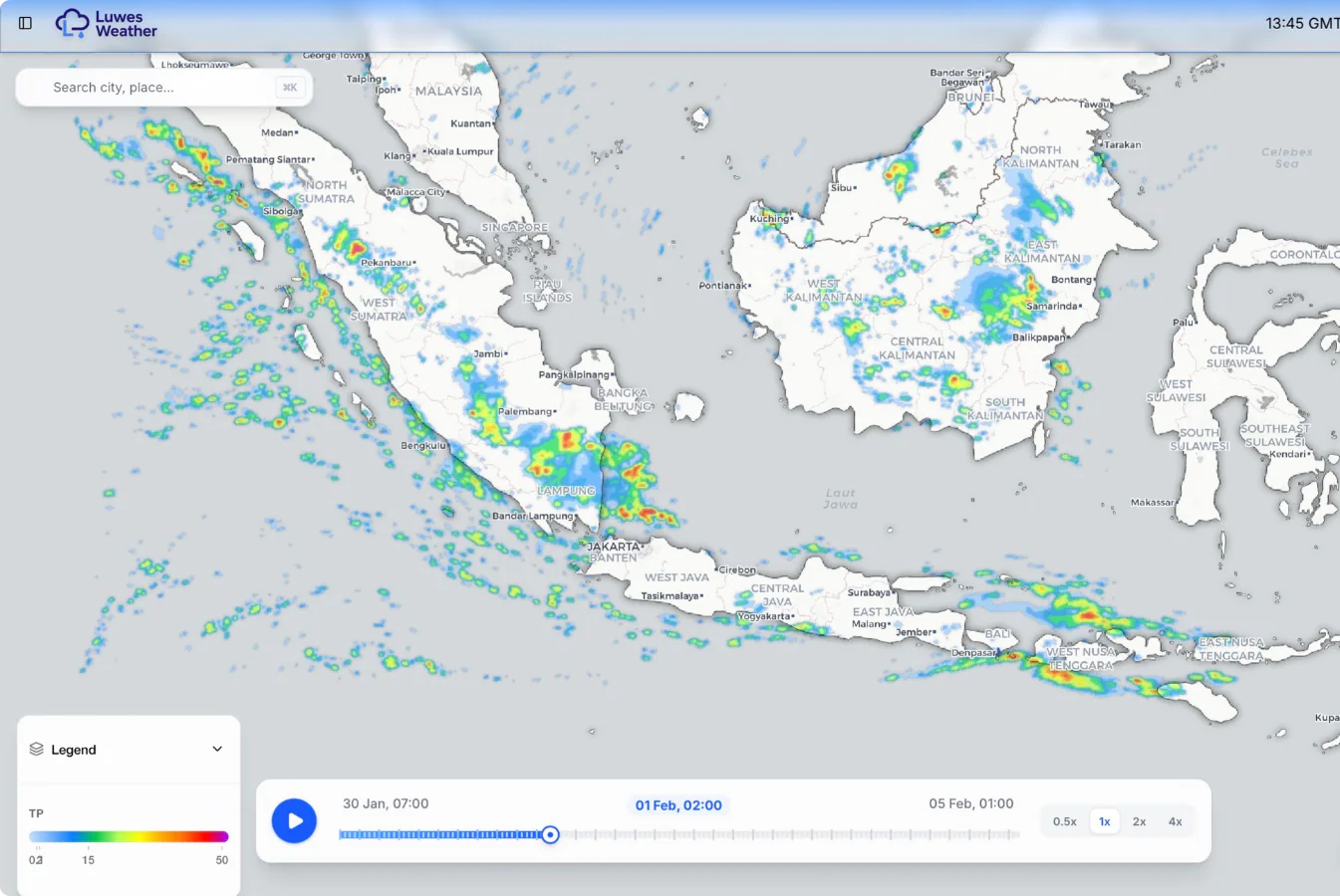
Confirm coverage using your map location
Compare forecast information with local observations
Confirm the available variables for land or coastal use
- Coverage
- Confirm your area in the selected product
- Spatial Resolution
- Weather grid size follows the forecast product
- Soil Moisture:
- Confirm soil-data coverage
- Soil Moisture:
- Confirm available map detail
- Soil Moisture:
- Confirm represented soil depths and limitations
- Update schedule
- Forecast time steps follow the product
- Update schedule
- Confirm refresh schedule and data availability
- Update schedule
- Confirm the forecast period in the offer
- Data Delivery
- REST API
- Data Delivery
- Web Map Visualization
- Data Delivery
- Raster Layer
- Data Delivery
- Dashboard Integration
Weather Forecast Parameters
Core Weather Parameters
Precipitation
Temperature
Wind at different heights
Relative Humidity
Cloud Cover
Solar Radiation
Advanced Atmospheric Parameters
CAPE, DCAPE, CIN
Vertical Wind Shear
Storm Helicity
LCL and LFC
Atmospheric Thickness
Atmospheric Anomaly Analysis
Soil moisture information
Main Parameters
Water content by soil volume
Soil moisture index
Moisture around plant roots
Surface moisture monitoring
Uses
Irrigation planning
Drought monitoring
Flood risk monitoring
Land Productivity Optimization
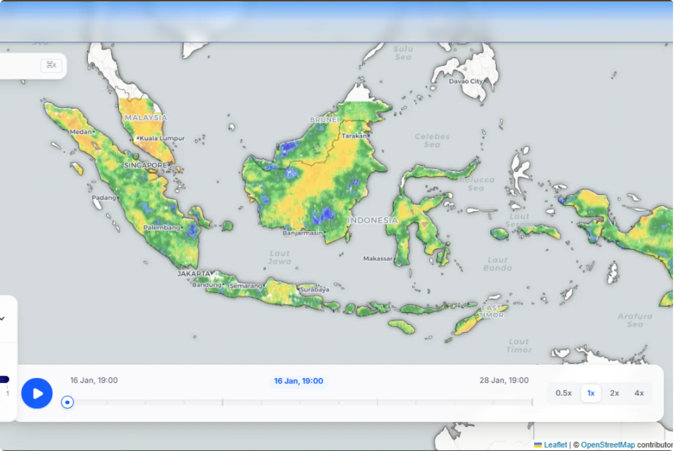
Check where the data comes from
Data-provider information
Name of the provider and selected product
Source of the available soil information
Area and time covered by the product
Quality notes supplied with the data
Field comparisons to discuss
Weather readings from an agreed station
Rainfall records from the selected gauge
Local observations with time and location
Soil checks appropriate to the site
01
Satellite
02
Data Fusion
03
Model
04
Output
Applications & Usage
Our weather monitoring solutions serve various industries and applications with precision and reliability.
Agriculture
Irrigation optimization and planting scheduling
Airport
Flight safety and operations
Research
Climate and meteorology studies
Industry
Work environment condition monitoring
- Agriculture
- Government
- Disaster Mitigation
- Energy
- Aviation
- Maritime
- Smart City
Technology Advantage
Satellite observations
Stable forecasts over time
Reliable measurements
Connects to existing systems
Options for different industries
Information for planning and decisions
Plan a system that fits your site
Separate what is happening at your site from what may happen next. AWS measures conditions at the station. Forecast data describes expected conditions for an area. A combined screen helps a team compare them, but they are not interchangeable measurements.
Step 1
Choose the site measurements needed for your work, such as rain, wind, temperature or humidity. The sensor list, accuracy and measurement range belong to the selected models, not to every AWS installation.
Step 2
Review a suitable mounting location with clear exposure and safe service access. Buildings, trees or nearby heat sources can affect observations. Confirm power, communications and who is allowed to view the records.
Step 3
If forecasts are needed, agree the area, variables, update schedule and forecast period. Compare the timestamp and source of each reading before making work plans. Ask for a demonstration using a location relevant to you.
What to prepare before asking for a quote
- Send the site location, photographs, activity to support and the weather conditions that affect it. Tell us whether you need local measurements, forecasts, historical records or a combination.
- Agree the station count, sensor models, data ownership, export format and users. Ask which costs cover equipment, installation, data access, renewal and service; these can be separate parts of the quotation.
Care and ongoing costs
Keep rain collectors clear, check sensor mounting and inspect power and communications. Sensor checks follow the selected manufacturer's instructions. Record service dates so users can distinguish a weather change from an equipment problem.
Know the limits
A forecast is an estimate, not a guarantee at each point. Six-day and seven-day labels on older screens are not a promise of the same package. Confirm the currently available forecast period, grid size and update interval in the demonstration and written offer.
Further reading on the underlying method: Spire — Forecast Resolution, Range and Refresh Rate
Questions before you order
Should I choose AWS or forecast data?
Choose AWS when you need measured conditions at a location. Choose forecast data when planning around expected weather over an area. Many projects use both, but the decision depends on your work, budget and the information already available.
Is online data access included forever?
Do not assume it. Confirm the access period, number of users, available exports, renewal cost and what happens to stored records when a subscription ends. Equipment purchase and data services should be clear before approval.
Explore the relevant equipment
- AWS — site measurements
Review station components and sensor choices.
- Spire — weather data
Discuss forecast coverage, variables and data access.
- ARR — rainfall recording
Consider a rainfall station when rain is the main requirement.
Complete Weather Solution
Plan with clearer weather and soil information
Let's discuss how we can help your business with the right IoT solutions